Monday, May 4, 2009

Day 30: Fletcher Bay

Hooray, the plankton bloom has faded enough so that I can see! The visibility isn't great, but I can see the bottom while swimming in water 8-10 feet deep (my typical swim depth).

I found some nice bull kelp (left). This one was very disorganized hanging from it's float in the absolutely still water (zero wind, zero waves, no motion at all).

This stillness is incredible. The photo at right is looking across the channel from Fletcher Bay to Kitsap County on the other side, about 2/3 of a mile away.

I've had several days this still out of my 30 swim days so far, and it's incredible to swim a mile through this thick-seeming glassy water. It's even more amazing on a day of light high clouds; the air seems to merge with the water. Absolutely the only disturbance on the water's surface is my wake as I swim. Can this really be the ocean?


air temp: 60F
water temp: 47F
May 4, 2009, 1pm, mostly cloudy
calm
high tide, rising
visibility 8-12 feet
today's distance: 1.01 mile
total so far: 34.36 miles

notables:
kelp
crabs
loon, kingfisher, and angry goose

I park at Fletchers Landing and walk to the mouth of Fletcher Bay. There's a grouchy Canada goose that wants to own the sandspit at the mouth of the bay, hissing at me as I approach the end of the spit.

I'm going to cross the channel on my hike, this is a fun hiking feeling, I have to go another half mile to my entry point, but there's an ocean channel in the way. No problem this time, I just dive in, swim across, and then resume my hike. That doesn't usually work in the northwest, it's too cold.

Walking north, there are quite a few cables running up from the beach to the top of the bluffs 50-100 feet up. The photo at right is a Bainbridge funicular (right), a cable car for going up and down the near-vertical slope to reach the private beach below from the house above. There are quite a few of these things, when you own waterfront property it's tempting to try to reach the water from your house, even if the beach is 100 feet below.

Click on the photo to enlarge it and see the details. The car is the dark spot at the top, you can see the cables going down through the bushes, and there's a concrete landing pad on the beach.

I get in the water, and slip under trying to disturb the surface as little as possible. It's amazing, the water is truly unmoving. Not a breath of wind, no puffs, no breeze, nothing. And the tide is almost high slack, so there's no current here.

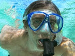
The plankton bloom is reduced, here's my Mark-o-meter (left), a photo of me taken at arm's length, about 24 inches. I'm more visible than in the last couple of Mark-o-meter photos. The color of the water in this photo is accurate.

Hey, I can see the cracks on the shoulders of my wetsuit in this picture. I guess I need to hope for the water to get warm so I can finish even if my wetsuit keeps falling apart.

I head for the mouth of Fletcher Bay and the grumpy goose. There's a slight flood pushing me into the bay mouth, so I drift slowly in. The bay gets murky and it's small, with a narrow entrance. I'm not planning on swimming far, and as the bay murk closes in I head out after only a few minutes and a mere hundred meters or so.

Back out of the bay, after a brisk swim against the slight tidal current. It's only noticeable because of the narrow bay mouth making it run in to fill the bay.

I see one new creature, a strange green crab (bad photo at right). Might be a helmet crab, I didn't get a good look or photo before it scuttled away into the dim depths. Also a school of small fish that dart away before I can identify them. A bit more swimming, past some nice kelp that drifted in from deeper water (photo above).

Then I'm at the point before the most remote coast on Bainbridge, there's no road ahead. Not sure how I'll manage the access here, might have to come at low tide and walk the beach for a distance, walk the trail down from Gazzam Lake, or just make a hellacious long swim of 2 miles or something like that. It'll give me somthing to puzzle over as the winds hit tomorrow and the rain socks us for the next week (predicted).

Thursday, April 30, 2009

Day 29: Battle Point

Nice scenery on the beach here on Battle Point. Unbelievable Pacific madrone tree (left), with the bark peeled off (normal) and a spiral pattern in the wood.

Also a very pretty lagoon (right). I swam this stretch on a super low tide, -2.5 and the day's high was 11.4 making a 14 foot tidal range. Clam diggers were out, I must have seen 10. That's the most beach traffic for any of my swims, and everyone was quite nice.

Interesting, one beachgoer had grown up on this beach and he said that beach use has gone down over the years, it used to be that there were many more people out on a nice day. Sad, I wonder if access is getting tougher? It was warmer today, making the swim and exit a bit more comfortable.

I was followed by 2 harbor seals today, one was smaller and maybe a young seal.

air temp: 60F
water temp: 48F
April 29, 2009, 4pm, partly sunny
wind from south 0-5 mph
very low tide, slack
visibility 2-8 feet
today's distance: 1.07 mile
total so far: 33.35 miles

today's notables:
plankton bloom
sand dollars
sand flats
crabs
2 harbor seals

I park at a friend's house and walk down the shared private beach stairs to what will be my exit point. Access is a problem here on Battle Point. It's warm (60F) and the beach is long on this very low tide, and it's not at today's maximum low yet. Wow.

Walking north on the beach to my entry point, about a mile, I can see it in the distance, the channel marker at the tip of Battle Point. I find a fish head on the beach, looks like a lingcod head (right). Also the madrone tree and lagoon shown above. A nice walk.

I find some huge sand dollar flats spread out above the water on this low-low tide (left). That's the Battle Point channel marker visible in the distance.

I get in at the channel marker and find the ebb tide is just ending. There was a bait of current as I started walking, but it's almost gone now. This is -2.5 feet, and the lowest tides of the year get to about -4 feet. With a maximum high of around +12 feet, that's a total of about 16 feet of tide as our maximum change. Today is a change of 14 feet in 5 1/2 hours.

The plankton bloom is alive and well, and here's my Mark marker of the visibility (right) a self portrait of me in the marine snow.

I can't see a lot of underwater detail, but the swimming is fantastic. Calm, glassy water, very low tide so I'm in the subtidal zone and plowing through a plankton soup so the Sound seems very much alive.

Here are two interesting starfish that are both in a curled up, bunched up posture. Almost looking posed.

My progress today puts me past 3/4, I think. The map (below) looks fairly complete, I can feel the finish line coming soon. And I have very much mixed feelings about that, I want to keep going but to where?

This plankton bloom is interesting the water is much clearer near my house, but the northern channel between Bainbridge and Kitsap County just stays bloomy, thick and has low visibility. This has got to be oceanographically interesting, but I can't explain it. I'd need aerial photos and current maps or something else that I don't have. And that's not what this swim is about.


View Swim Around Bainbridge in a larger map

Friday, April 24, 2009

Day 28: Battle Point

The westernmost point on Bainbridge Island, Battle Point (left). Named for a famous battle between two tribes that took place well before European discovery.

Swimming down the beach to Battle Point today was a lazy, hazy experience. Sunny and calm, warmer weather, no need to hurry, and the walk back on the beach was delicious and warm with the sun on my back.

The plankton bloom is now turning into marine snow (right). Bigger particles making for a strange low visibility scene. I can see a bit through the swirling snow, but not very well. Some places I can barely see the hand on the end of my arm. The photo at right is me with my camera held at arm's length in a particularly thick spot.

The next photo (left) is me in one of today's more clear spots. You'd never know from above that there's a snowstorm happening under the placid surface on this warm day.


air temp: 56F
water temp: 46F
April 24, 2009, 4pm, sunny
wind calm
medium tide, rising
visibility 3-7 feet
today's distance: 1.06 mile
total so far: 32.28 miles

today's notables:
plankton bloom
sand dollars
sand flats


More access trouble today, I have to park at the entry point, swim, and then walk back to the car. I haven't done this since last fall, I much prefer walking before I swim. But that's mostly because the wet walks started getting too COLD in November. I'll try swim first today and see how it goes.

The water is still thick with the spring Puget Sound plankton bloom. But the particles are getting bigger so it might be peaking. I'm guessing that bigger particles mean clumping and the aging of the bloom. At least I'm hoping that's what it means. It's fun to live in the plankton bloom, but I'd really like to see again. Try to picture swimming through this:


I swim out and in, looking for some clear patches. I wonder if further offshore will be better, but the clear patches seem unpredictable. I'll swim a bit and see if it gets better closer to Battle Point. The swimming is quite fine with the glassy water, bright sun and beautiful coast, and I can see far enough underwater to see what's happening on the bottom. I wander in and out to stay in view of the bottom, mostly from 3-7 feet.

Here's a huge bed of sand dollars, spreading over the last half of the swim. This photo is from about 2-3 feet away from the sand dollars, some other photos barely show the sand dollars from this distance.

Near Battle Point, I start getting small sheets of algae catching on my snorkel and getting stuck between my mask and snorkel. I have to keep shaking my head and pawing at the algae with my "lobster claw" 3 finger gloves. Finally, I pull out at Battle Point and lounge on this western shore in the warm afternoon sun. Here's the view looking south towards Point White and home (left).


View Swim Around Bainbridge in a larger map

Wednesday, April 22, 2009

June 27-finish date for Swim Around Bainbridge

I have big news...I will finish my Swim Around Bainbridge on June 27, 2009 if all goes well.

On June 27th, likely around 2pm, please come to a Swim Around Bainbridge Big Event at Ft. Ward Park on the southern end of Bainbridge Island. Everyone is invited to join the last small section of the swim, and you can walk, wade, swim, paddle, boat, or otherwise join in as I do the last little bit of my swim.

Then, we'll have a party. So mark your calendars and plan your day around the swim. Stay tuned for more as it develops.

Sunday, April 19, 2009

Day 27: Arrow Point

Manzanita Landing to Arrow Point. You can't get there from here. I set out with a bad plan today, beceause I couldn't make a good one. The water is thick with the spring plankton bloom, and visibility is down, so I can't go deep into Manzanita Bay and hope to see anything. I'll need to cross open water, and since there's no way to walk the shore on this leg, I'll have to cross the open water at least twice. This is going to be a real swim.

It's a gorgeous spring day, warming up and I have all the time in the world, no need to hurry. I end up swimming over 2.2 miles, and spending nearly 2 hours in the 45F water.

Today I saw a river otter on a dock and even managed to get a picture (right). I was shadowed by a harbor seal for the first half of the day, seeing it again and again, usually 30-50 feet away. I wasn't able to get a picture, it was too shy for that, and I didn't see it underwater.

The spring plankton bloom is still going strong, and the muddy bays had very low visibility, approaching zero. This is my last bay swim, and I'm looking forward to 10 miles of open coast until the finish.

air temp: 56F
water temp: 46F
April 18, 2009, 1pm, mostly sunny
wind from the north, 5 mph
medium tide, falling
visibility 0-10 feet
today's distance: 1.75 miles
(extra swimming to reach starting point: 0.47 mi)
total so far: 31.22 miles

today's notables:
river otter
harbor seal
loon
sand dollars
piddocks
kingfisher

Here's a map of the swim, I park at Beach Rd (the blue dot on the left, near Venice), walk north east to Arrow Point (yellow line), swim across the mouth of Manzanita Bay (red line), walk around the point (yellow line) and swim across the little east arm of Manzanita Bay (red line) to Dock Rd. and Manzanita Landing (the blue dot on the right, near Manzanita). After a total of about a half mile of swimming, I start my "swim" (blue line) along the shore, cutting across Manzanita Bay about halfway from the mouth to the end where the visibility drops to near zero. I get out at Beach Rd. on Arrow Point.


View Manzanita Bay swim in a larger map

The first swim is 0.3 miles across the mouth of Manzanita Bay in open water. Visibility is 5-10 feet, and the murk comes in patches. I keep a close watch above the surface looking for boats. In the middle of the bay, I see a harbor seal alongside, only about 25 feet away, looking at me. I try to get my camera out, but it's gone. I keep watching and it shadows me for quite a while, never getting closer and never allowing a picture. As I reach the shore, there's a river otter on a dock, and it's calm enough to let me take a picture (top of post). Then it drops down under the dock on a float, and rests there above water but hidden carefully. I'd never notice if I didn't see it go down there.

I walk the shore to my next swim, 0.17 mile across the small arm of Manzanita Bay. This arm is murkier, and visibility is only about 3-5 feet. I find the bottom when I get to about 4-5 feet of water, and swim over to Dock Rd. and Manzanita Landing.

Here's where the swim begins. The bottom is muddy, and there's a lot of life buried. I can see clam siphons and a million holes in the mud, many of them probably ghost shrimp.

I work into the small arm of the bay on the north shore, until visibility drops to 1-2 feet, then I head across to the south shore. There looks to be more current here when the tide runs, the bottom is sandier. Moving around the point and into the big arm of the bay, there are rocks coverred with barnacles and lots of shell debris. Also some live oysters on the surface, even a few big ones (left).

I spot a mesh bag, it has small oysters in it. It looks like someone put them in the bay to grow, maybe part of the Puget Sound Restoration Fund's great work restoring native oysters to the Sound. This might even by Morgan Rohrbach's project, she's a mom with a daughter in my son's preschool.

I head further south, into the bay, until I can't see the bottom while I'm swimming in 2 feet of water. Time to cross over and head west around Arrow Point. I'd like to see more of the bay, but even if I swim it I won't see it. And it's getting to be a pain to walk around the floating docks, I don't want to swim under while I'm alone (might get tangled in something), I don't want to swim around, so I go to the shoreline and climb over, what a pain. Walking around a dock or two lets the water drain out of my wetsuit so I feel cold all over again when I get back in the water. Ugh.

Another crossing of the bay, then just a regular shoreline swim to get to my exit point. I'm a bit tired by now, and I'm feeling the coldness of the water. This is a long day's swim and portage. Maybe the cold feeling has something to do with the ongoing decomposition of my outer wetsuit. Here's a shot of the cracked and leaky rubber on my shoulder and the gap on my ankle where the seam has split open. Yes, that's skin showing on my right ankle and calf, brrr. I definitely need the shorty underneath this old rag.

I had hopes that Patagonia would sponsor me by donating a new wetsuit, but they don't seem interested. Too bad, I thought they were a natural sponsor. Maybe I'll try O'Neill since I'm actually wearing a 20 year old O'Neill that belongs in their wetsuit museum. I'll trade them straight across for a new one!!

Finally, the shoreline and a bunch more docks to go around, under, and over. I come across the sandbar visible in the satellite photo and pull along in 18 inches of water. It's fun to examine the bottome in minute detail in such shallow water with the bottom inches from my face. I hear a loon laughing at me, is it because of this odd snorkeling in nearly no water?

Around the corner, past the big armored bank on the tip of Arrow Point (left). Just as I'm about to get out, here are some of the biggest sand dollar flats I've yet seen (right). This photo also gives a good sense of what it looks like to swim through the murk. The water here is about 4-5 feet deep, and visibility is about 5 feet and the water is very green, as in the photo. Puget Sound during a bloom.

This bloom is funny, near my house on the south end the water is clear. I keep checking by my house before I go swimming on the north end, and it's clear down south and murky up north. What's up? I would expect mixing and eveness after a couple of days, but it's been distinctly different for about 2 weeks.

Saturday, April 11, 2009

Day 26: Manzanita

A beautiful, blustery day and some strange magnetism drew me to what promised to be a murky swim. The wind was blowing alongshore and the sandy bottom was stirred. With the ongoing spring plankton bloom, I expect murky water and that's what I get.

Enjoy the sublime beauty of the day from the beach (right).

Below the surface, the conditions match my mood (left). Regardlesss, I want to plow through the thick water, swimming against the chop, and see if I can find some clearing.

air temp: 51F
water temp: 45F
April 11, 2009, 1pm, partly sunny
wind from the south, 10-20 mph
very low tide, rising
visibility 0-10 feet
today's distance: 0.98 mile
total so far: 29.47 miles

today's notables:
river otter
sand dollars
murk


I park at Dock Road, there's a small sign memorializing Manzanita Landing, which dates back to the late 1800s. Walking the beach to my start, I see two interesting sights. Sand dollars exposed by the very low tide (right). Lots of sand dollars.

And then a river otter, scrambling across the beach from a stream. It hops into the ocean, looks around, and dives underwater. Too quick to get a picture. I've heard of the river otters going into the ocean and now I've seen it. I wait around but it doesn't show itself again.

One day running at Ft. Ward state park, I saw a big otter cross from a swampy area to jump into the ocean. I've seen a lot of sea otters in my life, and that's what it looked like. It seemed too big for a river otter, and it was stocky rather than the thin weasel shape of a river otter. Odds say it was a river otter, but it REALLY looked like a sea otter. Today's otter is small and weasel-looking, it's a river otter for sure.

I get in the water by Hidden Cove Rd, and it's murky. Darkish and hard to see, this will be more of a swim than a dive. I wander further from shore and closer to shore, looking for patches of better visibility. At one point I can't see my hands held out at arm's length in front of my face. It's still fun to swim, even when I can't see much. Finally, I get a bit of clarity, maybe 5 feet of visibility (left).

Yeah, that's after a bit of clearing. I'm in about 4 feet of water and I can just barely see the bottom. Suddenly, out of the gloom I can see the sun, a bright glowing sunflower star (right). This picture is completely unaltered, no added brightness or color. It's a truly amazing orange starfish.

Plowing head on through small waves and thick murky water eventually gets me to the end of the swim, Manzanita Landing at Dock Rd. Next, historic Manzanita Bay, home of some of the island's early industry and a big dock.

Wednesday, April 8, 2009

Day 25: Seabold

Two new visitors today, I saw a harbor seal following me and a nice sea run cutthroat trout under the Agate Pass bridge. Riding the current out of the passage and along the shore was fun, until a huge eddy put me against the current for about a half mile.

The day was perfect, sunny and getting warmer. I wasn't cold getting out of my wetsuits. The drive to my parking site at the exit and my walk along the shore were both nice, I'm swimming south now along the more rural western shore of the island. Here's the view looking south from Hidden Cove Road (left photo). Yes, those mountains are real, they're the Olympic range on the Olympic Peninsula just west of Bainbridge. Here's the view looking north towards the bridge just visible in the distance (right photo).

I think I'm 2/3 done, with 28 miles covered out of an estimated total swim of about 40 miles. Once a week and I'll be done by the end of June.

air temp: 57F
water temp: 45F
April 7, 2009, noon, sunny
wind from the north, 5-10 mph
low tide, rising
visibility 5-15 feet
today's distance: 1.54 mile
total so far: 28.49 miles

today's notables:
harbor seal
sea run cutthroat trout
kelp
piddocks and geoducks

I park at Hidden Cove Road road end, and start walking up the shore to the bridge. The tide is just starting to flood, and I can see current running south, the direction I'll be swimming.

I get in just under the bridge and head southwest with the flooding tidal current, ready to turn south once I clear out of the narrow pass. What's this? Just as I reach the end of the pass, I see an adult sea run cutthroat trout, a fantastically beautiful fish, and a very lucky find in the ocean. They live nearshore, and run up the Bainbridge creeks to spawn in the early spring. They're sparse in the ocean, I'm happy to see one.

A fishing friend confirms that searun cutts hold in the pass, hugging both shores, right exactly where I saw mine. I didn't have a chance for a picture, so click here for a nice underwater picture of a sea run cutthroat trout.

Coming out of the pass, I see more kelp than anywhere else I've been, some tangles of it whipping in the current. Also some fields of some big clams.

The current works with me for maybe a half mile, then suddenly turns against me in a big eddy. I swim hard to get through, but it lasts for about a half mile, making for a longish swim through this middle section. The water is fairly murky, and it's mostly hard work and not too exciting, until I notice a harbor seal peering at me from further off shore, maybe 30-40 feet away.

I hold very still, with just my eyes out of the water, watching. The seal watches back. Finally, it ducks underwater and I watch half in-half out of the water. I swear I can just see it at the faint edge of visibility, but I can't be sure. I wait for a couple of minutes and don't see it, so I start swimming slowly, watching both underwater and above the surface. Finally, it surfaces right in my wake, exactly where I was when I first noticed the seal. It's following me for sure. Then it ducks underwater and I don't see it again.

Meanwhile, the current is still working against me. Until, suddenly, I'm out of it and the current is pushing me forward again. Thank goodness, I was getting a bit tired.

There are fields and fields of clams here (see photo at right), they look like piddocks to me thanks to some ID tips from commenters.

The last half mile passes quickly, running with the fairly swift current. I'm out, it's sunny and warmer, the beach is beautiful and the far shore is ringed by snow-capped mountains, and a bald eagle is flying overhead. Just another ordinary day on Bainbridge Island, with an ocean to enjoy and land to admire.