Wednesday, May 27, 2009

Day 33: Crystal Springs 2

This is the land of murky water, at least right now. My lowest visibility swim yet, if not for a family fun plan I would likely have stayed out of the water. But then again, spring plankton blooms are a part of life here, so why not swim through a soupy spring day in the Sound?

Today's low tide is -3.4 feet, one of the lowest tides of the year. With today's high of 11.8 at 6:52 pm, that's a tidal range of 15.2 feet in just over 6 hours. Wow.

My wife and kids dropped me off at the north end of my swim, Crystal Springs Rd by Baker Hill Rd. The plan is for me to swim just over half a mile to the Point White pier, where they'll be looking for interesting things exposed by the super low tide and playing in the water. Kids seem to swim in any water, even 51F, it's amazing. I remember those days, but it hardly seems real since I only get in this water with a lot of rubber on my body.

The plankton is thick, part of the time I can't see my fingertips with my arms extended in front of me. I watch above the surface or swim with one arm ahead of me at all times to avoid running into something.

When I arrive at Pt. White pier, there are my two kids frolicking along with some friends from the hood (left). That's my 7 year old daughter in the green shirt and my 4 year old son in the orange shirt, and their friends next to them. The adults are smartly standing at the edge of the cold water, watching.


air temp: 58F
water temp: 51F
May 24, 2009, 11:30 am, sunny
wind variable, 0-5 mph
extremely low tide, slack (-3.4 feet)
visibility 1-5 feet
today's distance: 0.62 mile
total so far: 37.17 miles

notables:
algae bloom
extremely low tide, excursion 16 feet

I get in at Crystal Springs Rd, and immediately realize this is a low visibility swim. The shoreline is muddy brown, with visibility about 1 foot. Further offshore, I can see up to 5 feet but I can't see the bottom clearly anywhere. It's a foggy blur through the soup. I opt for swimming out of the gloom, even where I can't see the bottom.

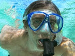
"Where am I?" (right) I do a few dives just to see what's on the bottom, and find myself in 10 feet of water above some amazingly colorful starfish on a big boulder. No hope for a photo, except a green cloudy view of the blogfish.

When I pull out of the water, it's great to have a greeting, and spend an hour poking through the algae and sand, digging hopelessly after retreating geoducks, looking at great critters, and generally having ocean fun. Here's a picture of my wife standing by Pt. White pier (left), the water reaches within a few feet of the dock on a high tide.

The mussel crust on the pilings is just one of the interesting sights (right).


View Swim Around Bainbridge in a larger map

Monday, May 25, 2009

Day 32: Crystal Springs

Another beautiful day in paradise. Here's the Crystal Springs shoreline as I walk north from where Crystal Springs Rd is along the shore, to my entry point. Ah. The weather and water are warming up for the summer, the wind is dead calm, and the beach is gorgeous with big trees right down to the waterline. Does the water look a bit cloudy to you?

Yes, unfortunately there's a new plankton bloom in town. Murky Murk returns (right). The visibility is low and I have to stay in shallow water if I want to see the bottom, mostly 5 feet or less.

It's a nice swim, but not a lot of view of the bottom and underwater photos just don't show much besides murk.


air temp: 66F
water temp: 50F
May 22, 2009, 4pm, sunny
wind from N, 0-3 mph
medium tide, rising
visibility 3-8 feet
today's distance: 1.21 mile
total so far: 36.55 miles

notables:
schools of small fish
algae and plankton

I walk north from Crystal Springs Rd towards the Gazzam Park shoreline. I can see that the water is cloudier than my last swim, but I never know how bad visibility will be until I actually get underwater. Sometimes the water looks fairly clear from above and turns out to be cloudy, and once in a while the surface view looks worse than the underwater view.

Today, the underwater view is actually worse than I expected, even though the surface view looked murky. Oh well, I can still see well enough to make the swim worthwhile.

Here's an interesting photo I took (left), I put the camera on the bottom pointed straight up in 6 feet of water. My head is just visible in the corner, a few bits of algae are visible, and the surface isn't really visible, it's just a glow.

The shoreline has some concrete walls, they look like erosion control structures since they run down from the shore into the deeper intertidal area (right). They've done what such structures do, accumulate sand and gravel on the upcurrent side and starve the downcurrent side. Catching gravel at the expense of the beach downcurrent. There are about a dozen or more, so somebody spent some money trying to save the beach (or the houses on shore). It creates a scalloped effect to the beach.

Once again, my close view of the bottom shows me another fun barnacle rock (left). Does that water look a little green to you? The color is completely unaltered, it's green.

Soon I'll come around White Point and see my finish at Ft. Ward State Park, maybe two more swims.

Friday, May 8, 2009

Day 31: Gazzam Lake Preserve

Today I swam one of the least developed shoreline areas on Bainbridge, the shore of Gazzam Lake Preserve. Access was difficult, I had to bushwhack in my wetsuit, but it was worth the trouble. Here's a picture of the shore (left) showing gigantic trees growing undistirbed all the way down to the high tide line. Fantastic.


Another calm day, and I found myself noticing something very small, a barnacle feeding frenzy (right). That's a clamshell in the upper left, and small barnacles enlarged in this close-up photo. Click the photo to enlarge even more and look for the fan-like cirri (legs). Barnacles are small crustaceans that live on their back, kicking their feet up into the water to filter out food.

As if that's not strange enough, there's the even stranger barnacle mating strategy, with the very long prehensile penises that allow mating while the animals are both locked inside their own houses. Mating for the anti-social.

These barnacles are making hay from the ongoing plankton bloom that is keeping visibility down. At least I could see well enough to make it a great swim.


air temp: 58F
water temp: 47F
May 8, 2009, 4pm, mostly sunny
wind from N, 0-3 mph
medium tide, rising
visibility 8-12 feet
today's distance: 0.98 mile
total so far: 35.34 miles

notables:
crabs, crab rock
barnacles
deserted shore

Today's access is either a long walk from Fletcher's Landing, or finding access from somewhere near the end of Crystal Springs Rd. Since Crystal Springs Rd is part of my neighborhood, I choose the hunt.

I drive to near the end of Crystal Springs Rd and find a vacant area where I can park and try to bushwhack to the beach. It's a long, steep, brushy hill leading down to the water. It works ok, although the last 30 vertical feet are almost straight down, I have to use trees like a ladder. Then I'm on a beautiful and deserted beach, with a view south towards Rich Passage and home (left).

I walk a mile north to the place just south of Fletcher's Landing where I got out last time. I pass the Gazzam Lake Preserve trail, and the undeveloped shore in the picture above. It's nice to see what an undeveloped shoreline looks like. There are only a few places on Bainbridge where houses could be built but aren't. And now I'm one of the few people to know that from close-up personal experience.

I get in the water, curious about what things will look like after the big storm of several days ago. The plankton bloom is still hanging in there, and the water looks about the same as during my last swim.


Swimming south, I find another Bainbridge funicular (right). Click the image to magnify, you can see the cable car at the top and the cables coming down to a concrete landing pad on the beach. Now that's determination to use the beach.

Here's a moon snail that was sliding among the rocks and gravel (left), I've usually seen them on sand. There is sand just a tiny bit deeper here, so maybe it's worth a brief walkabout on gravel for this big snail.

The ocean isn't remarkable downslope from the undeveloped beach, that's interesting. I don't know what I expected, but I thought I'd notice that the undeveloped shore somehow made a difference in the water. Nope. It looks the same. The gravel beach at the north end of Crystal Springs Rd is covered with barnacles, and somehow I notice them whipping the water in their feeding frenzy. I haven't noticed them feeding so vigorously anywhere else, it's worth trying to get a good photo (see barnacles at the top right of this post).

Then I'm out and bushwhacking back up the hill, thankfully nobody notices me and I'm away in the car, sneaking in and out for another private access success.

Monday, May 4, 2009

Day 30: Fletcher Bay

Hooray, the plankton bloom has faded enough so that I can see! The visibility isn't great, but I can see the bottom while swimming in water 8-10 feet deep (my typical swim depth).

I found some nice bull kelp (left). This one was very disorganized hanging from it's float in the absolutely still water (zero wind, zero waves, no motion at all).

This stillness is incredible. The photo at right is looking across the channel from Fletcher Bay to Kitsap County on the other side, about 2/3 of a mile away.

I've had several days this still out of my 30 swim days so far, and it's incredible to swim a mile through this thick-seeming glassy water. It's even more amazing on a day of light high clouds; the air seems to merge with the water. Absolutely the only disturbance on the water's surface is my wake as I swim. Can this really be the ocean?


air temp: 60F
water temp: 47F
May 4, 2009, 1pm, mostly cloudy
calm
high tide, rising
visibility 8-12 feet
today's distance: 1.01 mile
total so far: 34.36 miles

notables:
kelp
crabs
loon, kingfisher, and angry goose

I park at Fletchers Landing and walk to the mouth of Fletcher Bay. There's a grouchy Canada goose that wants to own the sandspit at the mouth of the bay, hissing at me as I approach the end of the spit.

I'm going to cross the channel on my hike, this is a fun hiking feeling, I have to go another half mile to my entry point, but there's an ocean channel in the way. No problem this time, I just dive in, swim across, and then resume my hike. That doesn't usually work in the northwest, it's too cold.

Walking north, there are quite a few cables running up from the beach to the top of the bluffs 50-100 feet up. The photo at right is a Bainbridge funicular (right), a cable car for going up and down the near-vertical slope to reach the private beach below from the house above. There are quite a few of these things, when you own waterfront property it's tempting to try to reach the water from your house, even if the beach is 100 feet below.

Click on the photo to enlarge it and see the details. The car is the dark spot at the top, you can see the cables going down through the bushes, and there's a concrete landing pad on the beach.

I get in the water, and slip under trying to disturb the surface as little as possible. It's amazing, the water is truly unmoving. Not a breath of wind, no puffs, no breeze, nothing. And the tide is almost high slack, so there's no current here.

The plankton bloom is reduced, here's my Mark-o-meter (left), a photo of me taken at arm's length, about 24 inches. I'm more visible than in the last couple of Mark-o-meter photos. The color of the water in this photo is accurate.

Hey, I can see the cracks on the shoulders of my wetsuit in this picture. I guess I need to hope for the water to get warm so I can finish even if my wetsuit keeps falling apart.

I head for the mouth of Fletcher Bay and the grumpy goose. There's a slight flood pushing me into the bay mouth, so I drift slowly in. The bay gets murky and it's small, with a narrow entrance. I'm not planning on swimming far, and as the bay murk closes in I head out after only a few minutes and a mere hundred meters or so.

Back out of the bay, after a brisk swim against the slight tidal current. It's only noticeable because of the narrow bay mouth making it run in to fill the bay.

I see one new creature, a strange green crab (bad photo at right). Might be a helmet crab, I didn't get a good look or photo before it scuttled away into the dim depths. Also a school of small fish that dart away before I can identify them. A bit more swimming, past some nice kelp that drifted in from deeper water (photo above).

Then I'm at the point before the most remote coast on Bainbridge, there's no road ahead. Not sure how I'll manage the access here, might have to come at low tide and walk the beach for a distance, walk the trail down from Gazzam Lake, or just make a hellacious long swim of 2 miles or something like that. It'll give me somthing to puzzle over as the winds hit tomorrow and the rain socks us for the next week (predicted).