Monday, March 30, 2009

Day 23: West Port Madison

An interesting day and a fantastic new find for me, sea butterflies (see photos at right). Hard to believe they're real, these little molluscs are less than an inch long and they flap around slowly like lazy gelatinous butterflies of the sea.

It's Corolla spectabilis, the spectacular corolla, a type of sea butterfly or pteropod. The wing plate is flapped down in the upper photo and flapped up in the lower photo (right).

Pteropods have been much in the news lately, the subject of fears that they'll dissolve in our future acidifying ocean. They're essential food for salmon and other ocean animals, and their shells are likely to suffer from CO2 causing ocean pH values to lower (becomming more acidic).

A real reward for splashing through some choppy water. Here's a photo of a spectacular corolla and a description


air temp: 46F
water temp: 44F
March 29, 12 noon, mostly sunny
wind 5-10 mph from the n
medium tide, falling
visibility 5-15 feet
today's distance: 1.19 mile
total so far: 25.42 miles

today's notables:
sea butterflies (spectacular corolla-a pteropod which is a type of swimming snail)
crabs, one eating a moon snail
laughing loon
harbor seals


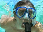
Strange weather today, it was calm at the South end of Bainbridge Island, and when I get up to the north end where I want to swim I find a nastly little onshore wind of 10 mph creating choppy whitecaps and roiling the water. I'll go into the water anyway, despite less-than-ideal waves beating on the shore.

Access is difficult up here, there are no shoreline roads that go from where I'm getting it to where I'm getting out. I have to rely on walking the shore which is nice if it works. Halfway along, I can tell I'll make it to the entry point. This is a fine sandy beach, it should be fun to swim back.

I find a nice field of worms on the beach, little tubes sticking up out of the sand. At low tide they're uncovered and visible to a person on shore(right).

Walking to get in, I scare 6 harbor seals off a floating dock, wonder if I'll see them again later?

I get in the water at the entrance to Madison Bay, and start pounding into the small waves. The slapping and pushing of the waves makes me work to keep rhythym and progress, catching my arm sometimes and stopping progress or splashing water into my snorkel. It feels like the 4-wheel drive version of ocean swimming. Big swells are easier, chop is a pain. Some of the time I duck my head a bit underwater, put my arms at my sides and just kick and work my body to drive through the waves. It seems almost as fast as a crawl stroke.

I hear a loon laughing at me and I keep looking around but never see the darn bird. Is it laughing at my plight swimming like a clod in this choppy water?

It's animal-eat-animal day here in West Port Madison. I see a crab eating a moon snail (left), I didn't know they could do that. Later, a literature seach confirms that big rock crabs can crack open the shell of a moon snail.

And...again and again I find crab debris, the dismantled remains of big crabs (right). Is it the seals?

Here's a truly lovely giant plumose anemone, fully unfurled. It's standing alone, over a foot tall (left).

Finally, as I'm getting out, I see more and more sea butterflies (pteropods). They're small but amazing little creatures, flapping away with their wing plates looking like little...well...butterflies in the sea. Amazing, I've never seen them before and today there are hundreds swimming around me.


View Larger Map

Thursday, March 26, 2009

Day 22: Madison Bay

I never expected to see a shark in little Madison Bay. So imagine my surprise when I saw this big shark bearing down on me with it's mouth wide open.

I managed to get my camera pointed in the right direction and I got one picture of the shark zooming at me with it's mouth open (left) and then another one of this big shark chewing on my leg (right). Fortunately, I came through the attack with nothing but a few scratches.

Another day, another harbor. I was worried going in, but hopeful I wouldn't find the same negativity as in the last harbor. It didn't work. I found myself feeling dismal in a murky harbor with too many docks and boats.


air temp: 48F
water temp: 44F
March 26, 12 noon, partly sunny
wind 0-5 mph from the E
low tide, rising
visibility 2-15 feet
today's distance: 0.94 mile
total so far: 24.23 miles

today's notables:
big oysters
giant plumose anemones
kelp crabs
burrowing shrimp/worms
murky-murk

Madison Bay is nice at first. I walk past some beautiful dinner plate-sized oysters lying on the muddy sand in the lower intertidal, walking to the harbor entrance during low tide. Entering the water, I see some nice burrows in the sand, probably ghost shrimp. Then I see the shark buoy.

The shark was a bad omen. Finding the shark buoy in Eagle Harbor was the beginning of the sinking feeling that hit me there.

The bottom is sandy mud and covered with bits of algae and algal debris. Then I see some fantastic orange-pink giant plumose anemones (right). Wow. They must be close to a foot tall. The visibility is fairly good, maybe a bit more than 10 feet and I think I can actually get a decent picture inside the harbor.

Soon I come to the first of many docks, and find a pair of nice kelp crabs hanging on a piling. I see a nice calm crab first (left), then a pugnacious crab with bigger claws comes at me, ready to do battle even though it's only about 3 inches long (right).

The water is getting more and more cloudy, and the bottom is getting softer. It's Murky Murk taking over. I pass under a few more docks and start getting that sinking feeling again, I was worried about this. With little to see except a green-brown haze around me and human structures to go under and around, the swim is starting to feel like nothing more than swimming in a clumsy and confining suit in dark, cold, uninviting water. Ugh. I was worried about this feeling.

Finally I stop when the visibility drops to about 2-3 feet and I can't see the bottom unless it's close enough to touch. I don't want to go around some docks just ahead that float at water level. Here's what it looks like when I get out short of the end of the bay, I can't make myself go on all the way to the end.


View Larger Map

Friday, March 13, 2009

Day 21: Port Madison

The swim from the sandspit to Port Madison begins the crossing from the east side of the island to the west side. Around the northwest corner of the island is Agate Passage where the tide roars through a narrow opening between the mainland and Bainbridge Island.

photo: looking northwest across the mouth of Madison Bay, with Agate Passage in the background, about 2 miles away.

Today's swim crosses the mouth of Madison Bay, and includes an excursion into Madison Bay. It's more than a mile long and I have to decide how far into the bay to go. I started across long gravel flats in fairly murky water. Then it was around a corner into Madison Bay where the visibility dropped to near-zero. The bottom is mucky with decaying algae and the water is cloudy. Not a lot of fun, and I have a better time swimming on my back and looking at the fabulous sun and blue sky silhouetting the dark green fir trees, along with the views of snowcapped mountains in both directions.

I go as far as the narrow point at the bay entrance, maybe a quarter of the way into the bay. I probably won't go further into the bay, I'm getting tired of murky bays on this round-island traverse and I don't want to go back down into the doldrums I found myself in when I went all the way through the much larger Eagle Harbor and then back out the other shore, for 3 days in the harbor.

Port Madison is site of early habitation on Bainbridge Island, both native Americans and early European settlers around 1850. Here's a sign on the shore about the local history (left).

Once there was a bustling port here, and the first town on Bainbridge Island followed construction of a lumber mill by George Meigs (photo, left). A historical source mentions "Seattle is a lumber town across the bay from Port Madison."

Later Meigs built ships in the area and in the 1870s, Port Madison alone exceeded the production of sailing ships over the entire San Francisco Bay Area." Port Madison was the first county seat of the then-named Slaughter County (soon renamed Kitsap County), and home of the first school in the county.

Now it's a sleepy area with prestigious waterfront homes, many with docks. This photo (right) is the same area as the photo from the historical sign above.


air temp: 46F
water temp: 45F
March 12, 1pm, sunny and gorgeous
wind 5-10 mph from the NE
low tide, rising
visibility 0-15 feet
today's distance: 0.93 mile
total so far: 23.29 miles

today's notables:
starfish
algae
oysters
murk

I get in at the lagoon entrance, and wade out across the flats. Dipping in the knee-deep water, I pull along looking at a zillion clam and oyster shells. The water is fairly clear, not a bad day although the little wind waves are enough to roll me around just a bit.

The bottom is sand and gravel flats, with eelgrass covering about half the surface. Agate Point looms ahead, and the corner leading to the west side. The snow-capped mountains are out and beautiful in the clear cool sky.

The mouth of Madison Bay comes quickly, and the tide is filling up the bay so it'll get even quicker when I turn into the bay. It's nice swimming with a running tide, makes the swimming each. I can watch myself flying over the bottom when I put just a bit of energy into swimming.

The water is getting cloudier and cloudier as I move into the bay. Also the bottom is gravel with mucky algae on the rocks. It just looks a bit nasty here. In my head is the presumption that there are a lot of people living around the bay, but it might not be anything simple like that. Could just be the natural way of things here.

Cloudy water is bothering me, so I roll over and swim otter-like on my back, watching the view above the surface. I often do this for a moment of contrast, and to counterpose as a yoga instructor would say (bend my back the other way). I have some powerful flippers and it's easy to kick for some speed and watch the swirling water behind me. Especially nice when the water isn't inviting.

As I get out a harbor seal is watching me carefully. I didn't see it underwater, it was too far away for that in this murky water. This is the closest I've been approached by a marine mammal, except maybe the sea lion that cruised by when I was getting in near the Country Club. Another canid came up to me when I reached the shore, wagging it's tail.

Wednesday, March 11, 2009

Day 20: Point Monroe

Point Monroe on maps, the Sand Spit to locals. It's the northeast corner of Bainbridge Island and it forms a shallow lagoon. The lagoon warms up in the sun, and today was no exception, it was probably a nice 50F compared to the 45F of the open water.

image: beloved Fay Bainbridge logs. Kids climb and float on these for HOURS

The high point of today was riding the flooding tide into the lagoon. As I got closer I started getting pushed towards the lagoon entrance until finally the water was like a rushing river. No way to swim against this tide. It was a strong flood, and the current was probably more than 5 mph at the maximum flood.

Endless eelgrass flats again today, and a fortune of sand dollars in the lagoon. Also a surprising number of golf balls, probably 100 or so spread over the area around the sandspit.


air temp: 40F
water temp: 45F
March 10, noon, mostly sunny
wind 0-5mph from the NE
low tide, rising
visibility 0-25 feet
today's distance: 1.47 mile
total so far: 22.36 miles

today's notables:
moon snails
huge sand flats with lots of eelgrass
ghost shrimp and mud shrimp
golf balls(!)


I get in the water at Fay Bainbridge State Park, where the geoduck boats are dredging again (still). The water is murky, but I soon clear out into bright, sunny, and clear water. Ahhh!!! This looks almost tropical, but the icy fingers stabbing me all over are a very clear reminder that this ain't the tropics.

I swim across more of the beautiful Fay Bainbridge eelgrass flats, this time I head out a bit deeper since it's so clear, out to around 15 feet. There are crabs creeping, moon snails sailing, and sparkling light all around.

I cross over a few golf balls, what's this? I haven't seen a single one yet in my traverse of Bainbridge's shore. Eventually I'll pass perhaps 100 or more during the course of a mile, mostly in clusters. Is this some sort of local tradition? Golf practice hitting off the sand? Odd.

Pulling around the corner and heading west, I get a glimpse of the point that guards Agate Passage. A couple of miles ahead is the narrow passage between Bainbridge and the Kitsap Peninsula, where the currents rip on a moving tide. Also where boats whiz by close to shore in large numbers. My next big challenge.

The bottom here is very strange. It's entirely covered with woody debris. Logs, sticks, and twigs form a solid layer. There are no trees directly above, why does it collect right here? It's unique, maybe the tidal back and forth somehow delivers wood? Digging into the bottom here would find some unusual creatures, under the anoxic sediment caused by the decaying wood.

Around and around the sandspit, and then I can see the entrance to the lagoon. I've planned this swim on a flood tide rising from a substantial low. This should be good. I'm about an hour into the beginning of a 7+ foot tidal rise, and I'm heading into an 20 acre lagoon with an entrance less than 50 feet wide. That's a lot of water to move through a small opening. It must go pretty fast...we'll see. Of course I didn't bother to scout, just do it. My back of the envelope calculations say the maximum flood tide should produce several hundred cubic feet per second (CFS), which is a strong flow for a channel of this size.

A few hundred feet away from the lagoon entrance, I can quit swimming and drift. Here's a photo of the lagoon entrance at a low slack tide, before the current starts rushing in (right). I'm getting pushed towards the opening at the speed of a slow swim. The closer I get, the faster I go. Just before the entrance, I try to stand up just for fun, in about 3 feet of water, and I can't quite manage to hold myself. I'm soon pushed over and further into the lagoon. Then the channel narrows and the current really starts to rip. This is like a swift river now, no way I could swim against the tide or even stand up. Not that this is a problem, I'm getting pushed into a nice sandy/muddy little lagoon and if necessary I could get to the shore and drag myself out.

In fact, it's fun to get swooshed by the tide into the lagoon, rushing much faster than I can swim. Where the current roars, I'm bobbing over some 6 inch sand dunes on the bottom below about 2-3 feet of water, and the sand is dancing in the waves. I'd like a picture but I decided to concentrate on what's happening and the camera is safely in my fanny pack, zipped away. No chance to pull it out now.

The current keeps ripping until I'm a ways into the lagoon, looking at a sand dollar colony. And...the biggest oyster shell I've seen on this swim. About a foot long, 6 inches wide, and 2 inches deep. That was one big oyster. There are only a few here, but they seem to be doing fairly well since they're big.

The water is noticably warmer once I'm in the middle of the lagoon. Maybe 50F compared to the chilly 45F out in the Sound. I imagine on a sunny summer day after a high tide it's fairly nice to swim in here. The bottom is getting muddy further into the lagoon, and there are some very nice burrows in the sand/mud bottom. I wonder who's home? Probably the bay ghost shrimp or blue mud shrimp. I've dug these and their colleagues many times in more southerly beaches. It would be fun to find the innkeeper worm, Urechis caupo, but I don't think the stray this far north. This would be the right habitat, though. Once upon a time, I wrote a scientific paper on this most phallic of worms.

Here's a map of the sandspit and lagoon. I swam from Fay Bainbridge Park, just out of the picture on the lower right, around the outer shore of the sandspit, into the lagoon entrance at the far left, then through the lagoon to the lower right by the Park.


View Larger Map

Wednesday, March 4, 2009

Day 19: Fay Bainbridge State Park

Today I reach the northeast corner of Bainbridge Island, after starting Oct 12 on the southwest corner. The distance may not be quite halfway, but it feels like halfway. I'm going to make it around, and my target date for finishing is July 4, 2009. I hope to get others to join me to finish the Swim Around Bainbridge on that most American of days (and likely a warm day!).

I crossed massive sand flats today, on a very low minus tide. That's nearly 12 feet lower than the high tide Monday morning. We have some fairly big tides here, and that shapes the nearshore life.

Fay Bainbridge State Park is a popular place, and a favorite family spot. My wife played there as a girl living east of Seattle, and she took me there right after we met (before we moved here). It's a beautiful northwest beach.

Today's theme is crabs, both observing and being.


air temp: 55F
water temp: 45F
March 3, 3:30 pm, mostly sunny
wind calm
very low tide, slack
visibility 10-20 feet, occasionally near zero
today's distance: 1.46 mile
total so far: 20.89 miles

today's notables:
geoducks and piddocks
northern feather duster worms, orange tube worms
moon snails
huge sand flats with lots of eelgrass


I get in the water near Brackenwood Lane, and it's a very low tide. I can see shallow sandflats spreading far from the water's edge. Without planning, I start doing what I call a "crab crawl." Swimming a front crawl stroke but planting my fingertips on the bottom on each stroke. I'm "walking" on my fingertips like a crab, in crab heaven habitat. There are dungeness crabs everywhere.

The flats are covered with eelgrass, and I found a funny patch in the sand that caught my attention:

Oh my, it's a crab buried in the sand. Let's go closer.


It's two crabs, in a mating embrace it seems. Soon after I took these pictures, the happy couple burst out of the sand and tried to scurry away.

I pursued them just long enough to get a couple of pictures of the two crabs embracing. The first one is blurry as they're racing away, then the next two show them more clearly, as they're calming down and settling down.


Finally, one last picture as they sneak away into the darkness of deeper water and thicker eelgrass.

These crabs are amazing and fun to watch. Here's more on their mating habits.

I see more tube worms here than I've yet seen, probably because I'm below the tidal zone and into habitats that never go dry at low tide. There are orange tube worms and feather duster worms.


Another sight I wonder about, two boats that have some sort of motors running while at anchor, and tubes going over the sides. Could they be dredging geoducks? I've heard about this, the dredgers blast water into the bottom to pick up geoducks. I find clouds of murky water with near-zero visibility when I swim by the boats, but that doesn't prove they're dredging. I find similar clouds elsewhere now and then.

Here's a map of progress to date. I'm on the opposite corner of the island from where I started!


View Larger Map