Thursday, December 18, 2008

Day 13: Wing Point

Fun of a different sort at Wing Point. Strong south wind brought actual swells to Puget Sound, and the Wing Point sandbar created near-surf conditions at the point. Rocking and rolling in 8 feet of water made for a real ocean swim day. Stormy weather was a great time to hit Wing Point.

(photos: Wing Point from the water. Interesting how the character of a place changes day to day.)

Just inside the sandbar, where the water was a bit deeper and more sheltered, moon snails scoured the sand. Turbulence brought movement to the sandy bottom, and the sand waves (like mini sand dunes 1 inch tall) were marching slowly towards shore.

Some surprise visitors dropped by, and you should hear more about that next week.

air temp: 36F
water temp: 49F
Dec 17, 1pm, mostly cloudy
wind strong from the south, 20-30 mph
high tide, falling
visibility 5-15 feet
today's distance: 0.75 mile
total so far: 13.51 miles

today's notables:
moon snails
stormy conditions with sand waves on the bottom

Today I'm joined by Seattle Times reporter Michelle Ma and photographer Erika Schultz. We meet at the ferry dock (glad that's over with) and drive over to Hawley Cove. We talk a bit, they take some pictures and video, and then I get in the water.

Or...I try to get in the water but a bright blue broken ballon floats up to my ankles. I can't stand balloons in the water, they're terrible for wildlife. I pluck it out of the water and whine a bit about the harm caused by balloons and other trash. Like the discarded lighter on the beach. Argh, what about a light-hearted fun swim?

I resolve to dive in and have some fun, but a plastic bag floats around my calves the next time I try to get in. OK, this is too much, staged by King Neptune for the benefit of the news people. I can see writing, somebody is going to get fingered for ocean abuse. It's...OLD NAVY. How perfect is that, a store called Old Navy polluting the ocean with a totally unnecessary single use plastic bag. I can't leave it, so I pick it up and rant a bit about plastic bags killing ocean animals.

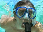
Then, finally, it's into the water. The cold shock wave hits, every time I swear the water has gotten colder. Even though I know it's coming, somehow I can never quite get used to the initial blast of cold, followed by the icy fingers of water leaking in through the seams, gaps, and actual holes in my wetsuit. The cold ring on my face is probably the worst, so I drop in for some quick swimming to fight the chill.

The south wind has a swell running, so the swimming is harder and the waves smack me around enough to cause extra flushing. That's cold water pouring into my wetsuit in a big flush instead of the more typical icy fingers. In a few minutes I'm warmed up and ready to go.

I can see the waves breaking on Wing Point, I saw them from the beach actually. It should be a bit of a wild ride out there.

No sand dollars here, the colony must be closer to the ferry terminal, just offshore of the west side of the Hawley Cove beach. I recommend it highly.

Splashing through the waves, this is much more like ocean swimming than the first 12 legs of my tour. Not a lot of exciting bottom action, most of the action is above the surface. I hear motor noise and look up, it's the ferry coming towards me. But no worries, I have a big red buoy drawing a line in the sand. Ferry on that side, me on this side. I'm glad to hear how loud the boat is, there's no way I could miss a boat this size coming nearby, even with all the wave noise in the water and a rubber hood over my ears.

I see a brilliant, beautiful moon snail bobbing along down there on the bottom. Or rather I'm bobbing up and down so the moon snail slides closer and then further away in time with the waves. I duck down and peer at it, it's a big one at least a foot long with a shell the size of a large soup bowl. Motoring along visibly, oblivious to the action above. It's a relief to finally get under the surface thanks to the majesty of a moon snail.

This is a transition that's usually easier, with my typical calm wind and glassy water swims. But with all the action on the surface and above, getting under is more difficult.

It's like looking at one of those split perspective images, where it's either two faces looking at each other or a vase depending on how you look at it, likeRubin's "ambiguous vase" illusion, visible here. How does this relate to oceans? As I talked about my tour with Michelle, I had a new insight into what I'm finding.

Getting underwater is like going through Alice's looking glass in Lewis Carroll's "Through the Looking-Glass, and What Alice Found There," more commonly known as Alice in Wonderland. She plunges through a mirror and finds a very different world.

Most of us only see the surface when we look at the ocean, we miss the underwater world. Thus a beautiful Eagle Harbor looks surprisingly different and much sadder from underwater. This is true even for me, an ocean person with clear knowledge of what I'd find under a typical marina thanks to my scientific experience.

I'm building a new underwater awareness, the ability to look at the water that I've already toured and easily get through the looking glass and re-enter the underwater consciousness. And I hope I can convey a little bit of that to others who may not choose to get there the way I do.

Now that I've gone through the looking glass on today's swim and found myself focusing underwater, I notice something beautiful.

The turbulent, tumbling water is stirring the sandy ocean bottom, making the sand waves dance. These are the mini-sand dunes that are formed on a shallow, sandy ocean bottom, maybe 1 inch tall and 2 inches wide. As I look closer, I can see some sand particles lifted off the bottom each time a wave passes, and the sand waves are very slightly reshaped. This is the march of the sand waves, they're reforming before my eyes.

What fun this is, to find a miniature drama on the ocean bottom.

I watch the sand waves for a few minutes, hovering and riding up and down in the waves, and then head on out to the tip of Wing Point.

There are some wave deflectors built with concrete here, and a heavily armored shore. No wonder why. Crashing waves make this look like an exposed coastline instead of a sheltered Puget Sound shore.

It's a lovely roller coaster ride and I spot a person watching me from a living room window. I wave and she waves back. Hi. I'm having fun, how about you?

She may wonder, what is someone doing in the water during Seattle's most disruptive winter storm, with snow and cold (cold for us). My answer, I'm going through the looking glass for an adventure.

It's a quick swim back, running with the wind and swell. There's no good exit for me here, and it's just as easy (and more fun) to swim back to Hawley Cove to get to my car. I'll start at Wing Point next time, and head Bainbridge's outer coast to Yeomalt Point, where I've been warned about the rip currents. Yeomalt is an Anglicized version of a native word that means "where the currents meet."

Sounds fun, especially during a storm.

But to finish Wing Point right, I want calm water so I can explore the sandbar better. It's hard to see everything that's here from a roller coaster.


View Larger Map

Tuesday, December 16, 2008

Day 12: Ferry yard and ferry dock

The air has a chill, it's a match for today's swim. Around the ferry maintenance yard in a half mile loop through the harbor channel, then back to shore and under the ferry dock. A bit tough, it needs proper staging. But fantastic, with the sun, calm water and view of Mt. Ranier (right).

What better day to have my brother in town, and the reprise of mischevious scheming from many years ago? My wife, brother and sister-in-law (left photo) will drop me at Waterfront Park just after the ferry leaves. I'll swim out to the channel and around the rusting hulks of dead and disused ferries, and hopefully under the ferry dock before the next boat arrives from Seattle. They'll be nearby to quiet the alarm if anyone gets too worked up over a guy in a black rubber suit swimming under the ferry dock, and they'll get some action photos.

Quick and quiet, and hopefully no Homeland Security alerts.

At least that was the plan...

I'll admit to being a little nervous driving to the harbor. The swim is totally reasonable, there's nothing beyond limits. Everything should be fine. I wonder if it might seem otherwise to some, like an extreme sports thing. Interesting. Is that how extreme sports happen, after working up to something it seems reasonable, but from the outside it looks nutty?

The dropoff goes well, walking through the snow in a wetsuit definitely seems odd, but the chill doesn't really cut through the rubber and I'm not outside long enough to get cold. Quick gear on, a few photos and I'm in. Thanks team.

I stroke harder than usual out into the channel, between a dock, an empty ferry slip and a old ferry boat resting at the pier (photo at right). It feels strange to be heading out into the channel and I pause frequently to look around. I want to know the where, what, and who over everything moving anywhere close to me. I won't trust my ears alone, even though motor sounds are so clear and distinctive.

The loop around the ferry maintenance yard is taking longer than I had hoped. It feels like more than the half mile I calculated on my Google map, maybe I'm swinging wider than I had figured. It takes what seems like a LLLLOOOOOOOOOONNNNNG time to get out and turn east around the boats, headed for the ferry dock. (Note: it's more like 3/4 of a mile, the satellite photo in Google maps is old and there's a lot more dock and boats to swim around now).

As I make the turn and come within view of the ferry dock, I see the next ferry come around the point from Seattle, heading for the ferry dock. I'm not going to cross under the ferry dock before the next boat arrives. I'm not going where the boat goes, I'll be closer to shore swimming under the pilings of the ferry dock, well away from the ferry. But I'm worried that the security people will be more intent when there's a boat at the dock. Oh well, I could sprint for the dock, but I don't think I'd make it anyway. Change of plans.

Finally, after what seems like a long 30-40 minute swim, I pull around the last boat and turn for the shore (photo at left). I'm the little splashy dot near the docked ferry boat. I'm swimming free in murky brown/green water in the bright sun, with no sign of the bottom. I want to get close to shore and out of the channel, then I just have the ferry dock security to worry about.

Here's the bottom, time to turn right and head for the ferry dock. The boat is just about to dock, it will arrive maybe 5 minutes before I get there. Swimming past the Harborview condos, the bottom is sand and gravel, with lots of shell debris. It's nice to notice that.

The cars start to drive off the ferry just before I arrive. I want to make this quick, I can see people walking along the edge of the car ramp that leads to the ferry, could it be security people waiting to wave me away? I put my head down and swim for the other side.

Will there be any obstacles under the docks? I usually swim slowly under a dock, watching all around, with one hand in front of my face in case I miss seeing some lines strung between pilings. But the sun is out and I can see fairly well even under the dock. I do keep looking around, and pause to check for obstacles, and everything looks fine (left photo).

Then...anticlimax, I'm under the car ramp and headed for the pilings that hold up the foot passenger ramp. Again, no apparent obstacles. I look up at the car ramp, see the same two people looking at me, it's my brother and sister-in-law. Great, no worries and I wave at them. I'm out the other side, and now if anyone objects at least I'm past the docks.

A nice feeling of relief, and I swim along the shore, wondering whether the human drama above the water leaves me capable of noticing anything underwater. I start seeing some tracks in the sand, about 1-2 inches wide and wandering several feet. But I can't tell who made them. Then there are more tracks and I can see...sand dollars. I haven't seen a single sand dollar yet this swim, and here's an entire city of them. I found a million dollars underwater, I'm a rich man.

It's a beautiful sand flat with what must be millions of sand dollars, mostly in 5-10 feet of water. They're piled up on top of each other, there are so many it hardly seems possible. Here's a link to a photo of a similar bunch of sand dollars.

What fun, a fantastic underwater site to close out the swim. I work slowly towards the shore, the sand dollars continue until the water is only about 4 feet deep.

My team is on the shore waiting, my wife first then my brother and sister-in-law (photos at left).


As I'm getting out, a small Coast Guard boat arrived and circled around offshore of the park. It's the 25 foot Defender class boat, with two deck-mounted machine guns, fore and aft, described here (photo right, and you can just see the Coast Guard "Defender" approaching as I get out of the water in the photo at the top of the post). We wonder if someone will meet us at the cars, but we're good and we get home without any problem. Next leg, on to Wing Point and my beloved open beaches again.


air temp: 29F
water temp: 49F
Dec 8, noon, sunny
wind light, variable
high tide, slack
visibility 10-20 feet
today's distance: 1.20 mile
total so far: 12.76 miles

today's notables:
sand dollars


View Larger Map

More Eagle Harbor day 11

I'm ready to get out of the harbor and back to the open coast. The Swim Around Bainbridge is showing me much, including better and worse than I expected. And now, I've got my first malady. It's industrial disease
of the psychic sort, caused by prolonged exposure to the dim views under the dire straits of a developed harbor.

(Industrial Disease: a disease arising out of, and in the course of employment, resulting from exposure to, the absorption of or intoxication from harmful chemical, biological or physical agents to which the general public would not normally be exposed.)

What a surprise, it's not the toxic sediments of the Superfund site, nor the E. coli hazard from swimming in someone's toilet. I'm brought down by the mundane underside of an everyday sight.

The mirror-like surface of the water hides an ugly view. Now that I've seen it, I'll never look at a harbor the same again.


air temp: 46F
water temp: 50F
Dec 11, 12:00 pm partly sunny
wind from North, 5mph
high tide, falling
visibility 10-20 feet
today's distance: 1.19 mile
total so far: 11.56 miles

today's notables:
clams, clams, clams

Today, Swim Around Bainbridge friend Rob Dryden helped with the shuttle. He contacted me via email and offered rides. Since the start and end today are in town, I wanted to avoid the typical hike. We left my car at the exit and Rob dropped me at the entry point. Thanks Rob (photo at right).

The first part of the swim was muddy, boring, and quite nice. It's not being in a harbor that's bad, I like this bit. One especially nice part is a shallow sandbar that I pull over using my hands, too shallow to swim. I'm face to face with acres of clams. It's mostly the dead shells that show, but also siphons and little water jets coming out of burrows in the sand.

But soon, I re-enter the hazardous harbor and clarify my diagnosis. I'm sure now, it's the marina that makes me feel bad swimming through the harbor.

I get out at Waterfront Park, take a quick gaze at the ferry yard coming next, and hustle off to my car to get back to work. My view of the wet underside of Bainbridge Island is modified by Eagle Harbor, and I think I understand the change.

Thursday, December 11, 2008

Day 11: Eagle Harbor

Swimming in a marina sucks. That's the answer to the attitude problem in swimming Eagle Harbor. One more little bit and I'm outta here.

I started from a nice little "road end" park on Gowen Road (photo at right). It's beautiful, even with the junk tire in the foreground. Notice the fantastic clouds and reflection in the water (photo at left).
We do grey here in Seattle, more on that later.

It was a good swim at first, a bit boring over the mucky bottom and with some docks to dodge. But bursts of sunlight were nice, the glassy water is always a delight, and the cold air and water made it even better since I was staying fairly warm. Well, a few cold toes.

But when I hit the marina, I started to feel like crap again. It was pathetic, swimming past the dock and moored boats, wondering how many poop molecules were leaking around the snorkel in my mouth and imagining what I would think if I were the people walking on the dock looking at the idiot swimming by. Here's the marina, looking to the right from my exit at Waterfront Park (photo at right).

So now I get the Eagle Harbor problem, I'll just swim on out of the harbor and never look back. I long for the open coast again.

just one tiny obstacle, the ferry dock looms. And, even worse, the ferry maintenance yard is before the ferry dock. Here's the ferry maintenance yard looking left from my exit (photo at left) Should I go around or under? Or, portage? Would that be cheating?

Wednesday, December 10, 2008

Swim Around Bainbridge on blog, Watching our Water Ways

Swimming Around Bainbridge is a beautifully simple idea.

So says Environmental reporter Christopher Dunagan in his blog "Watching our Water Ways" where he discusses the challenges of protecting Puget Sound and all things water-related. Here's his post on my tour:

Swimming around Bainbridge Island, a little piece at a time, is a beautifully simple idea loaded with potential for suspense, excitement and exploration.


Mark Powell // Kitsap Sun photo

Island resident Mark Powell wanted to find a way to know his island better when was struck by the inspiration to swim around it, observing the variety of sea life, shoreline structures and underwater formations along the way.

As Tristan Baurick writes for the Kitsap Sun, Powell considered waiting for the right weather or the right time of year to begin, but then he realized any delay could kill the inspiration. So he took to the water on a windy Columbus Day, Oct. 13, slipping into the cold water at Fort Ward State Park. (View his blog, which includes an entry for each leg of his journey.)

Meanwhile, I’ve been following the blogs of two 16-year-old boys, each sailing separately by themselves around the world. There’s Zac Sunderland of Thousand Oaks, Calif., aboard a 36-foot Islander, who left Los Angeles June 14 (See Zac’s Web site and blog).

The other 16-year-old is Mike Perham of St. Albans (England), who left Brighton on the South Coast of England on Nov. 16 in a 50-foot custom racing yacht. (See Mike’s web site and blog).

Both boys hope to be the youngest to sail around the world solo. It is a pretty remarkable feat to contemplate — what with risky seas, boat mishaps and dangerous people lurking in various corners of the world.

So I’ll keep following the adventures of these two boys who have their separate dreams of sailing. Their blogs contain details of their travels, which aren’t much while they’re at sea, but the photos are nice.

Still, my admiration goes to Bainbridge Island’s Mark Powell, whose trip is filled with adventure of a different kind. From Mark’s blog, I am hearing things about things somewhat familiar to me and personally more interesting.

As Powell writes in the introduction to his blog:

I’ve got an itch. I’m indoors too much, and lacking adventure. So, thrashing around a bit on what to do, it came to me.

I’ll swim around Bainbridge Island, my home island.

It’s all here, 53 miles of shoreline with at least a small dose of almost everything you’ll find in the modern ocean world.

We have a Superfund site and pristine shoreline, armored banks with fancy houses, and forests that reach the water. Some good fishing, and some sadness over what’s missing.

Thanks to Mike Sato for catching a name error in the initial post

Tags: Bainbridge Island, Mark Powell, Mike Perham, Zac Sunderland

This entry was posted on Monday, November 24th, 2008 at 6:27 pm and is filed under Education, On writing, Puget Sound, Shorelines. You can follow any responses to this entry through the RSS 2.0 feed. You can leave a response, or trackback from your own site.

Tuesday, December 9, 2008

More Eagle Harbor day 10

My Eagle Harbor swim vexes me. What's the source of my dismay in gazing at the Harbor's underside? Is it really so sad, or am I coloring the water somehow with my attitude? Could the pollution be in me?

I did see more garbage on this leg than any other, but that's no surprise. As a sharp contrast, Blakely Harbor was fun and glorious even though it's the site of long-abandoned heavy industry.

Eagle Harbor's dismality is a new puzzle, and I don't have all the pieces yet. I want to dive in again soon to swim the north shore and try again. In the next leg or two I'll reach the ferry maintenance yard and ferry dock, and the question of what to do. Around, under, or avoid? It would be so easy to slip under the ferry dock, so long as nobody raises an alarm.


air temp: 47F
water temp: 49F
Dec 7, 2:00 pm cloudy, light rain
wind calm
medium tide, falling
visibility 10-20 feet
today's distance: 1.56 mile
total so far: 10.37 miles

today's notables:
spotted ratfish
junk
shark buoy


Today, I have a timeline, I've got a mile to swim (or so I thought) and an hour before I'm due for the promised Christmas tree hunt with my kids. A wonderful swim first (or so I thought), then a nice family afternoon. My supportive wife drops me off and plays with the kids on the beach. She probably cringes as much as I do when I drop under the first marina. Maybe more, since it's harder to watch and not know whether there's a problem.

I'm cautious of obstacles, dangling cables that could snag and trap. But the first marina and dock are clear. At least clear of debris. The water is murky brown/green and it's dark and hard to see more than about 10 feet. I kick through the worst of it with my hands in front of me in case I miss seeing a problem.

No worries, it's clear swimming. And on to the next dock. I see a few oysters on the gravel and sand bottom, and a spotted ratfish. Enough to say it's not a dead ocean under all of this use.

It gets old, ducking under docks, swimming inside of a marina boom. I swim faster than usual to get past the worst of it.

But somehow, clearing the docks doesn't clear my head. I'm out in some open water but it's not that fun. I strike on ahead hoping to cruise through the murk and find something--anything--that transforms the harbor into a delight.

I keep stopping and watching for boats, I'm in a harbor and it's possible I could miss hearing the whine of the motor. Nothing except a couple of delightful kayakers, my first on these swims. They obligingly start to paddle by until I hail them. We chat a bit, me bobbing strangely at the surface without treading water. The buoyancy of two wetsuits is fun, I can float vertically at neck level with no work. They paddled over from Wing Point, ducking under the same docks, etc. No, I'm not really a maniac.

It turns into a long swim. My google maps measurements have to be off, I know I've gone a mile and there's some distance left to swim. My family gives up waiting when I'm not done in an hour, because they have to pick up a friend for a play date. We left a car at the exit point, so I can make it home, but I end up being late.

Finally, I come around the last point and head across the flats to the car, another quarter mile or so. It's murky, the bottom is silty, and I still feel down about the whole thing.

Whatsoever posesses me to turn day 10 so negative? I don't know, at least not yet. I'll be back to these sites or nearly so on my way back out of the harbor. For better or for worse.

Sunday, December 7, 2008

Day 10: Eagle Harbor

The beauty of Eagle Harbor shines in these photos (today's exit point looking left and right).


As I'm swimming through Eagle Harbor I see some big gaping jaws with nasty teeth, it's a big shark. Oh wait, it's a joke buoy, an attacking shark where you can tie up your boat.

I did meet some nice kayakers halfway through the swim, they asked if I was keeping warm (yes). I mentioned my path, and they wondered aloud in a friendly way if I'm a maniac. Naw, just an ocean guy with an itch to do this Bainbridge Island underwater tour.

The shark buoy was fun after a moments hesitation. Not so much fun in the rest of the human presence in this yucky swim. Unlike all 9 of the swims before today, this one was more of a lesson. Garbage near marinas and houses, some dark murky water, too many docks to swim under or around and bunches of boats.

You can probably see it coming in this sequence of photos of getting in the water. First, here's dad and the kids as I'm getting ready, getting in the water, and then about to disappear under the first dock. I guess I shouldn't have been too surprised, but it was worse than I expected.


I'm just disappearing under the first dock in the larger photo above, that little white dot is me.

Today's swim tested my mettle, whether I'd stick it out and complete the shoreline. The water was a beautiful above. But beneath, the Heart of Darkness. This is what we do to our beautiful ocean when we love it to death.

It's not the wounded ocean of massive commerce. In some ways that would be easier to take. This is the ugly scene of you and me, looking out from our single houses and clusters of boats, and neglecting what's beneath the beauty. Below the mirrored surface of the water is where we find our true reflection in the ugly shallows of Eagle Harbor.

I feel dirty and swim fast. I want to slip through as quickly as I can. There's nothing for me here.

I see a spotted ratfish and feel sorry for the poor thing. Prehistoric and magnificently strange, and living in a junky harbor.

How many people know what's down here? What proportion of the live-aboards and live-on-the-shores have even put on a mask and looked down here? Maybe I should tell them how bad it looks. More on this later..

Friday, December 5, 2008

Wild Places

What are wild places? I used to think Wilderness...you know, WILDERNESS. The big expanses of undeveloped land in the named and lawfully set aside Wilderness areas.

But there is the wild that lives in us, the feelings that mark our experience of the wild. And the feelings are not tied to named Wilderness areas. Sometimes they come out, surprise, with the sight of a wild bird in a fairly tame forest patch.

The wet underside of Bainbridge Island is wild. I've seen enough of it to know for certain. Underwater touring has taken me through a lot of water, and I've seen a lot of ocean bottom in my 8-some miles so far. I'm savoring the find of a wild world all my own, to be reached just by plopping off the beach and moving 100 feet offshore.

Give me fifteen spare minutes and a plunge underwater, and I can have a getaway that's as wild as most Wilderness hikes. Now that's a find.

The photo above right shows the wild water of the point between Rockaway Beach and Blakely Harbor, home of the tubesnout crew (see day 8). In the far background is wild Mt. Ranier, just peeking over wooded Blake Island.


I'm reading a book called "The Wild Places" by Robert Macfarlane. It's an adventure with a question at it's heart:

Are there any genuinely wild places left in England, Scotland, Ireland, and Wales? That is the question that writer Robert Macfarlane poses to himself as he embarks on a series of breathtaking and beautifully described journeys through some of the archipelago's most remarkable landscapes.
I picked it up as an accompaniment to my swim, and I've found it influential.

Macrarlane talks about the various wilds that he finds in England, and he finds his picture of what's wild changing dramatically as he moves through his adventure.

It's a good companion to my adventure, and I'm lucky to have found it.

Thursday, December 4, 2008

Day 9: Eagle Harbor

How about a Superfund site to spice up a swim? Or a prehistoric fish not usually seen in shallow water? Today was a fantastic sunny day with light wind and good visibility most of the way. I used two wetsuits to hold out the cold, and some new gloves, and I stayed warm. Even though I felt like I was in a full body cast. It was a nice swim with some strange spotted ratfish, and one disturbing site...

I passed the partially cleaned Superfund toxic waste site where lots of oily goop was found seeping into the ocean as recently as 2006. Nice. It's Bainbridge's worst ocean mess, except maybe lucrative strip mining of shallow sand flats to catch Geoducks. The Wyckoff creosote plant resulted in millions of pounds of creosote contaminating our ocean at this beautiful little sandy beach with a fantastic view of Seattle. Ugh.

Even with all of this ugliness, the sand flats had a wild feel when I pulled around the corner into Eagle Harbor and looked around.

photo at left: Wyckoff Superfund site and Eagle Harbor, taken from the ferry.

photo at right: Bainbridge-Seattle ferry passing Rockaway Beach and entering Eagle Harbor.


air temp: 45F
water temp: 50F
Dec 4, 11:00 am sunny
wind from the NE, 0-5 mph
medium tide, falling
visibility 10-30 feet
today's distance: 1.00 mile
total so far: 8.81 miles

today's notables:
spotted ratfish
superfund site

I got in at the north end of Rockaway Beach, after stumbling down a steep grassy hill, next to an old landslide. I'm wearing my shorty wetsuit under the cracked and torn old full wetsuit. I also bought some new, thicker gloves and I'm wearing my thickest booties.

The bottom is mixed sand and gravel, and lots of shell litter from clams and barnacles, along with a few oysters. I expect Geoducks, but don't find any. Right ahead are the steel walls of the Superfund site, they contain the contaminated soil to limit seepage into the ocean. They make for a very inhospitable shoreline, 10-15 feel of vertical steel walls, for maybe 1/4 mile along the point at the mouth of Eagle Harbor.

I look around quite a bit, I'm close to where boat traffic comes in and out of the biggest harbor on the island. The big boats stay outside the channel buoys, so I stay inside, but I want to watch for small boats. I'm in fairly shallow water and I don't think anybody would come this close to shore, but I'm keeping a watch just to be sure.

Once I'm in the harbor, the bottom shifts to sand, and I wonder how much has been placed to "cap" the toxic sediments from the creosote plant. The "cap" is supposed to keep the toxic mess in place, it's cheaper than trying to dredge the mess and dispose of it, but the whole process is a bit dodgy and prone to problems like movement of the sand that forms the "cap." It's probably the right solution, but it's far from perfect.

Did I say yet that I'm staying nice and warm today? Two wetsuits oughta do it, even though it's hard to move in this body armor. Better than getting cold, I guess.

Further around the corner, I see some strange looking fish on the bottom in about 12-15 feet of water over the sand. I can't identify them from the surface so I dive down and see what looks like a deep-sea fish. Wow. I've never seen anything like them in shallow water, only out the window of a submersible (deep-diving sub), or caught in a deep trawl net. I've been lucky enough to dive down as far as 10,000 feet in the Alvin submersible, at a hydrothermal vent and other interesting deep sea locations.

They're spotted ratfish, also known as a ghost shark or chimaera. These fish have cartilaginous skeletons like sharks and rays, and are mostly found in very deep water. There are a few shallow water species, including this one. Very nice fish, they're copper colored with bright white spots and big eyes, and they're beautiful in today's bright sun. They don't startle very easily, and I can get a really good look. There are at least 10 of them, lurking on the bottom with their heads into the slight tidal current so they look like they're in loose formation. There's a nice picture and comments here, on Elasmodiver.com.

These ancient fish are closely related to fish that lived 200 million years ago (ore older), and they have unusual mating habits, including a grasping arm that comes out of the male's forehead and grabs the female like a velcro sticker. The male has "claspers" that trasfer sperm to the female for fertilization, and the female produces just two embryonic offspring that live inside a leathery egg case that eventually gets deposited on the ocean bottom.

I can't believe my luck in finding these fantastic fish!!!! Here's a YouTube video of some spotted ratfish from a nearby location in Puget Sound.


View Larger Map

click blue markers for notes on progress